gundam world and me
gundam world
gundamworldandme.blogspot.com
http:/www.gundamworldandme.blogspot.com
News from around vancouver. will organize when i have time. for now, some news :)
-------------------------------------------------------------------------------------------------
january 29 09
january 29 09
Sewage-laced effluent spewing into Metro Vancouver environs (what more can i say?)
http://www.vancouversun.com/Technology/Sewage+laced+effluent+spewing+into+Metro+Vancouver+environs/1228544/story.html
------------------------------------------------------------------------------------------------- january 29 09
 Frustration shows, as Canucks duke it out.
Mitchell, Raymond exchange blows; Sundin reassigned to checking line. Another poor year for Canucks
-------------------------------------------------------------------------------------------------
january 28 09
woots a clear day whith a few feet of snow in grouse
-------------------------------------------------------------------------------------------------
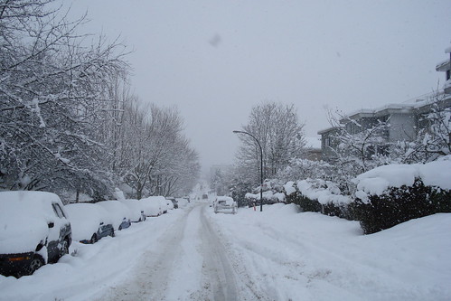
january 5 09
lots of snow 2 week ago for east van jan 05

-------------------------------------------------------------------------------------------------
January 4 09 SNOWFALL WARNING ISSUED!!!!

http://www.vancouversun.com/travel/Police+barricade+roads+conditions+deteriorate+across+Metro+Vancouver/1139673/story.html
Metro Vancouver8:22 AM PST
Snowfall warning forMetro Vancouver continued 5 to 10 cm of snow is expected over areas of the southern mainland and East Vancouver Island by Tuesday evening.5 cm of snow is expected over coastal sections of the north and central coast by tonight.20 to 30 cm of snow is expected over inland sections of the north and central coast by tomorrow afternoon.This is a warning that significant snowfall is expected or occurring in these regions. Monitor weather conditions..Listen for updated statements.
Southerly wind ahead of an approaching frontal system will rise to 60 to 90 km/h near noon along the north coast. Winds will ease early this evening as the front passes. Northeasterly outflow wind of 60 km/h will continue near mainland inlets and valleys until late this evening.A strong pacific frontal system is pushing onto the north coast this morning. With cold Arctic air in place, precipitation will begin as snow before changing over to rain this afternoon. Coastal sections of the north and central are expected to receive 5 to 10 cm of snow followed by 40 to 50 mm of rain. Inland sections will remain below freezing resulting in total snowfall amounts of 20 to 30 cm by tomorrow afternoon with highest amounts near Stewart and Kitimat.The frontal system will reach the south coast tonight. Flurries are expected to develop overnight and intensify to snow as the system makes landfall tomorrow morning. Temperatures will gradually rise throughout the day causing snow to become mixed with rain over much of the south coast. Areas further inland and higher elevations will remain as snow until the system moves inland tomorrow evening and precipitation ends completely. 5 cm of snow is expected over the south coast with up to 10 cm over the Fraser Valley and higher elevation terrain.
-------------------------------------------------------------------------------------------------


No comments:
Post a Comment